
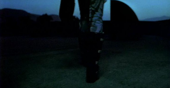
Multimedia > Escape From New York > Shooting Locations [Photo Removal/Credit: Email]
Studios/Facilities:
Culver Studios [Air Force One/Glider/Car Interiors]
9336 West Washington Boulevard, Culver City, CA 9023
New World Pictures/Venice Effects Facility [Special Visual Effects]
600 South Main Street, Venice, CA 90291
Dream Quest/Mar Vista Effects Facility [Special Visual Effects: Graphic Display Models]
12524 Indianapolis Street, Los Angeles, CA 90066
Georgia
 >
>
 >
>
 >
>
 >
>
 >
>
 >
>

Colorado Terminal Corridor [Deleted Scenes] [Hartsfield-Jackson Atlanta International Airport, Underground Walkway, Concourse A, Atlanta, GA] [Satellite View]
Description: Hartsfield-Jackson Atlanta International Airport is one of the busiest passenger airports in the world. Only O'Hare International Airport in Chicago, Illinois, rivals Hartsfield-Jackson in passenger volume and in number of takeoffs and landings. In 2012 Hartsfield-Jackson handled more than 2,500 arrivals and departures, bringing more than 250,000 passengers through the airport on an average day. Monthly the airport handles about 54,000 metric tons of cargo and more than 60,000 metric tons of mail on airliners and cargo aircraft.
The facility is named after two important Georgia politicians: William B. Hartsfield and Maynard Jackson. Hartsfield, a former alderman and mayor of the city of Atlanta, founded the airport at the site of an abandoned racetrack in 1925 and became its first commissioner. With support from the city and the attraction of such companies as Delta Air Lines and Eastern Air Lines, Hartsfield Airport grew quickly. The name Jackson was added to Hartsfield Atlanta International Airport in 2003, after the death of former Atlanta mayor Maynard Jackson. Jackson was the first African American to serve as mayor of a major southern city.
6000 North Terminal Parkway Suite 4000
Atlanta, GA 30320
https://www.atl.com
https://en.wikipedia.org/wiki/Hartsfield Jackson Atlanta International-Airport
Photo Credit: Palmer Wallace [1-3]
 >
>
 >
>
 >
>
 >
>
 >
>
 >
>
 >
>

 >
>
 >
>

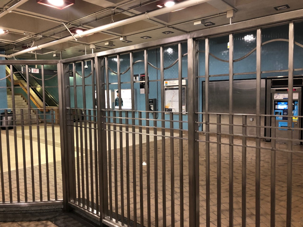
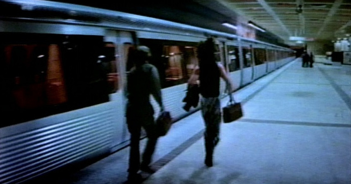
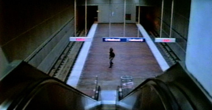
Colorado Subway Platform [Deleted Scenes] [Ashby Station, Westbound Platform, Atlanta, GA] [Atlanta's MARTA System] [Street View]
Description [MARTA]: The Metropolitan Atlanta Rapid Transit Authority [Marta] operates the subway and bus system in the City of Atlanta, Fulton and DeKalb counties. The rail system currently has 36 stations with 46 route miles. MARTA carries about 250,000 rail passengers on weekdays.
Description [Ashby Station]: The Ashby station is an unusual configuration. It is an underground station on two levels, with one track on each level. [If both tracks were on the same level, it would resemble one island platform and a side platform on the eastbound side.] The tracks are nearly over one another. You can see the tunnels split right past the west end of the station. The walls along the platform are marble, and the walls next to the track are blue tile. The ceiling is a waffle design painted white. There is a painting on the westbound platform, on the blue tile. This mural depicts the city of Atlanta and Atlanta University Center. The railing that keeps you from falling down to the lower level is painted blue. This station was opened on December 22, 1979.
Comment [Andreas/Webmaster]: "The train Snake Plissken and Taylor [Joe Unger] gets on is actually running in the wrong direction on the westbound track to tie it in with the Dome/GWCC/Philips Arena/CNN Center Station where the rest of the scenes from this sequence were shot two stations away from the eastbound track."
65 Joseph E. Lowery Boulevard
Atlanta, GA 30314
https://itsmarta.com
https://en.wikipedia.org/wiki/Ashby [MARTA station]
Photo Credit: 6DOSPodcast [1-5]
 >
>
 >
>
 >
>
 >
>
 >
>
 >
>
 >
>

 >
>
 >
>

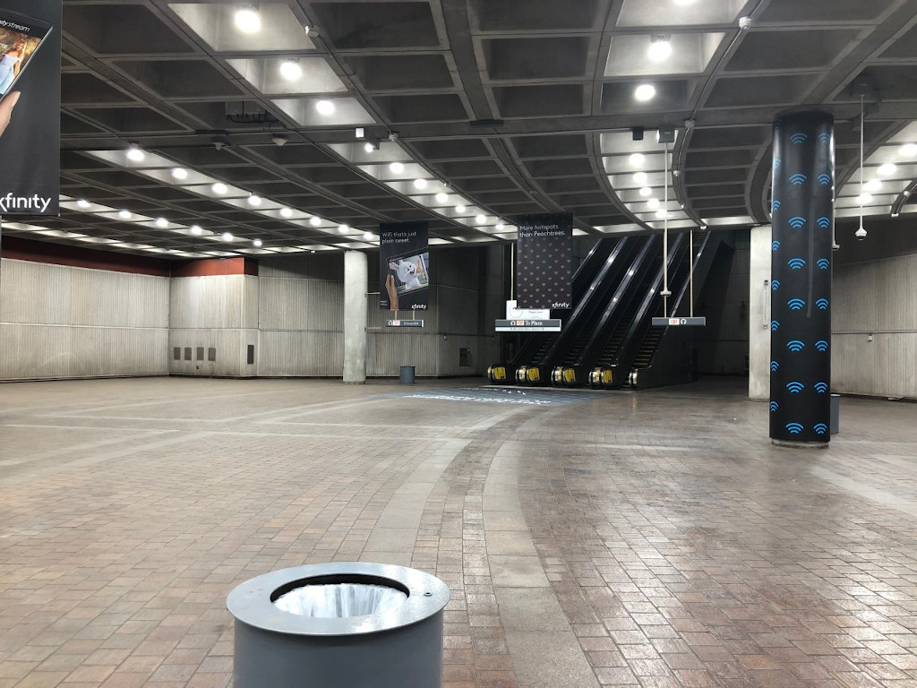
San Francisco Subway Platform/Upper Lobby [Deleted Scenes] [Dome/GWCC/Philips Arena/CNN Center Station, Atlanta, GA] [Ex Omni Station] [Atlanta's MARTA System] [Street View]
Description: Single island platform, two tracks, underground. The ceiling over the mezzanine and platform is waffled, and in each of the squares inside of them, there is an orange panel. Part of the ceiling over the platform is an arched waffle. Everything is made of cement. The west end of the station is briefly at the surface, covered by road bridges. Just past the station, the train goes back underground. This station has the most number of faregates and escalators to handle the crowds for events at the former Omni and Georgia World Congress Center. Today it services the new Phillips Arena, Georgia World Congress Center and Georgia Dome. While travel up or down the escalators there is concrete mural depicting the industrial revolution. This station was opened on December 22, 1979.
100 Techwood Drive, Northwest
Atlanta, GA 30303
https://itsmarta.com
https://en.wikipedia.org/wiki/Dome/GWCC/Philips Arena/CNN Center [MARTA station]
Photo Credit: 6DOSPodcast [1-5]
Missouri
A Look Back • 1976 Fire Along Locust Street Was One For The Ages [STLtoday/Apr 04/2010] By Tim O'Neil
A Look Back • Searing Heat Wave Killed 153 In St. Louis In 1980 [STLtoday/Jul 24/2016] By Tim O'Neil
How a 1976 St. Louis Fire Gave 'Escape From New York' Its Setting [Riverfront Times/Aug 19/2021] By Danny Wicentowski

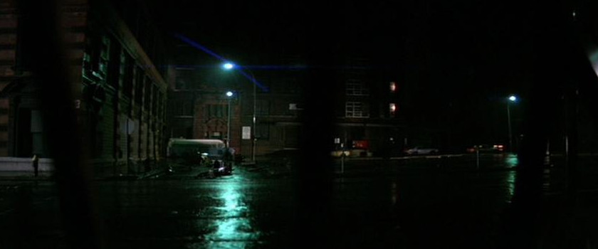
Chopper Landing Site/Street [Plissken] [Deleted Scenes] [Saint Charles Street btw 16th and 17th streets, Parking Lot, Saint Louis, MO] [Street View]
http://www.builtstlouis.net/washington/15a.html
http://www.builtstlouis.net/washington/17a.html
 [Street
View] >
[Street
View] >
 [Street
View] >
[Street
View] >
 [Street
View]
[Street
View]Street [Escape Pod] [Saint Charles Street btw 17th and 18th streets, Saint Louis, MO]
Comment [Erik Markarian]: "Where the pod actually crashed is an extension to an existing building to make it look like a hole was made in the wall. It would be where the wooden fence partition is. Nowadays from what I could see, that section is actually the front of a tenement-type of building and the fenced-off portion in my pictures is a child's play area with a few toys and things in there."
 [Street
View] >
[Street
View] >
 [Street
View]
[Street
View]Street [Air Force One Wreckage] [North 21st Street btw Saint Charles Street and Olive Street, Saint Louis, MO]
Description: The Swift Printing Company building in downtown St Louis can be seen in this scene. It was abandoned since Swift's move out in 1969. The building was renovated in 1991, and is now the home of the St. Louis Brewing Company - the makers of the Schlafly brand of beers.
http://www.builtstlouis.net/central-corridor/downtown-west/locust-street03.html
http://www.builtstlouis.net/central-corridor/downtown-west/washington-avenue02.html
http://www.builtstlouis.net/central-corridor/downtown-west/washington-avenue03.html

Air Force One Wreckage [20 Locust Street, Saint Louis, MO] [Locus Business District] [Street View]
Comment [Andreas/Webmaster]: "A St. Louis Housing Authority warehouse once stood here. It was destroyed by the fire in 1976."
http://www.builtstlouis.net/central-corridor/downtown-west/washington-avenue02.html
http://www.builtstlouis.net/central-corridor/downtown-west/washington-avenue03.html
 >
>

Theater [Exterior] [Fox Theatre, Saint Louis, MO] [Grand Center] [Street View]
Description: "No longer need residents of St. Louis look beyond their own city for the finest entertainment." This statement was coined by the William Fox Circuit of Theatres in 1929 for the opening of their newest, most exotic temple of amusement, and it still holds true! It was originally opened as a movie theater and the theater was restored to its original glory in 1981.
527 North Grand Boulevard
St. Louis, MO 63103
http://www.fabulousfox.com
http://www.builtstlouis.net/midtown/05a.html
https://en.wikipedia.org/wiki/Fox Theatre [St. Louis]

Chock full o'Nuts [Rear Of Building] [Saint Charles Street btw 22nd and 23rd streets, Saint Louis, MO] [Street View]
 [Street
View] >
[Street
View] >
 [Street
View]
>
[Street
View]
>
 [Street
View] >
[Street
View] >
 [Street
View]
[Street
View]Alley/Broadway [Locust Street btw 21st and 22nd streets, Saint Louis, MO] [Locus Business District]
Description: Incorporated in 1982 as a special tax district, the Locust Business District has expanded its objective to stimulating community morale and facilitating economic growth through the accommodation of emerging commercial markets.
http://www.locustbusinessdistrict.com
http://www.builtstlouis.net/central-corridor/downtown-west/locust-street01.html
http://www.builtstlouis.net/central-corridor/downtown-west/locust-street02.html
http://www.builtstlouis.net/central-corridor/downtown-west/locust-street03.html
Street [Bridge]/69th Street Bridge [Girders] [MacArthur Bridge, Chouteau's Landing, Saint Louis, MO]
Description: Located a few blocks from Busch Stadium, Chouteau's Landing is one of St. Louis' oldest districts. With 58 acres slated for mixed-use redevelopment, Chouteau's Landing will soon be transformed into an energetic art district distinctively styled with SoHo-style lofts, historic commercial buildings and new construction.
Creative entrepreneurs are already moving their businesses to Historic Fourth Street with its rare collection of 19th-century commercial buildings that will seamlessly merge with new construction. The launch of Chouteau's Landing's Historic Fourth Street will be followed by seven progressive years that include a 122,000-square-foot interactive arts center, art-filled greenspace and pedestrian friendly streetscapes.
Located just south of Highway 40 and Busch Stadium between South Fourth Street and the Riverfront, Chouteau's Landing will feature an edgy artistic sensibility and an intricately layered landscape that attracts a diverse community of savvy urbanites.

Street [Bridge] [South side of the MacArthur Bridge btw South 2nd Street and Risley Street] [Street View]
 >
>
 [Deleted Scenes]
69th Street Bridge [Girders] [North side of the MacArthur Bridge/Lombard Street/Risley Street] [Street View]
http://www.builtstlouis.net/macarthur.html
https://en.wikipedia.org/wiki/MacArthur Bridge [St. Louis]
 [Street
View]
>
[Street
View]
>
 [Street
View]
[Street
View]Alley Near Library/Street [Caravan] [West 16th Street btw Washington Avenue and Lucas Avenue, Saint Louis, MO] [Washington Avenue Historic District]
Description: The Washington Avenue Historic District is located in Downtown West, St. Louis, Missouri along Washington Avenue, and bounded by Delmar Boulevard to the north, Locust Street to the south, 8th Street on the east, and 18th Street on the west. The buildings date from the late 19th century to the early 1920s and exhibit a variety of popular architectural styles. The majority of the district's buildings are revival styles or of the Chicago School of architecture. Most buildings originally served as warehouses for the St. Louis garment district and are large multi-story buildings of brick and stone construction. Many have terra cotta accents on their facades. After World War II, the decline in domestic garment production and the preference for single-story industrial space led to many of the buildings being vacant or underused due to functional obsolescence.
The area began to experience some redevelopment in the 1990s. In 1998, the state of Missouri adopted a tax credit for the redevelopment of historic buildings, making large-scale renovation financially feasible. Local and national developers have acquired many buildings along Washington Avenue and in other parts of downtown. The buildings are being redeveloped with loft-style condominiums and apartments.
 >
>
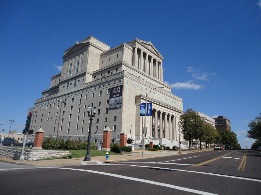
New York Public Library [Exterior] [The New Masonic Temple of Saint Louis, Saint Louis, MO] [Street View]
Description: The New Masonic Temple is a historic building in St. Louis, Missouri, built in 1926. Like many other buildings built for Freemason meeting places, it shows Classical Revival architecture.
Named a city landmark in 1976, the more than 386,000-square-foot building stands 185 feet high and has more than six million cubic feet of space. There are 14 levels with six full floor and eight mezzanine levels. The Temple's ground was broken in 1923 and dedicated in 1926. Created by well-known architectural company Eames & Young with consulting architect Albert Groves, it features classic Greek Ionic style exterior architecture with various styles throughout the interior.
The Masonic Temple is built in three receding stages, which is symbolic of the three steps in Masonry. Constructed of Bedford limestone with gray granite trim, the main lobby is finished in marble with other rooms featuring its original wool carpet. One of the property's many highlights is an unfinished theater with 2,200 seats.
The lobby has a 38-foot mural titled "The Origins of Freemasonry", which was created in 1941 by Jessie Housley Holliman and dedicated by Senator Harry S. Truman. It is the only surviving mural by noted African American artist Holliman in a St. Louis public building.
The Temple's history includes many prominent guests. It houses the former office of then-Senator and Free Mason Grand Master Harry S. Truman prior to his being President of the United States. Charles A. Lindbergh was initiated and participated as a mason at the Temple prior to his renowned 1927 flight. In 1980, Escape From New York with Ernest Borgnine filmed a scene on the Temple's steps. Borgnine, a mason, attended masonic meetings in the building.
Ground and first floors and first floor mezzanine contain areas where the general public is admitted only on days when a meeting is held, which is currently 10 per month. The second floor contains the Eastern Star quarters. Third and fourth floors and their mezzanines were designed to house the Blue Lodges with the potential for eight Blue Lodge halls. The four halls and the fourth floor were not completed, and one area on the third floor was made into a dining room.
Fifth and sixth floors were designed to house three of the York Rite organizations, which are known as the Chapter, Council and the Commandery. Most of the building is non-sectarian, but the fifth floor features Christian symbolism. The fifth level hall is 100" long, 75" wide and 48" high.
3681 Lindell Boulevard
Saint Louis, MO 63108
http://www.builtstlouis.net/midtown/02a.html
https://en.wikipedia.org/wiki/New Masonic Temple [St. Louis]

Street [Caravan] [16 Lucas Avenue Street, Saint Louis, MO] [Street View]

Street [Station Wagon] [North 17th Street btw Washington Avenue and Saint Charles Street, Saint Louis, MO] [Street View]

Grand Central Station [Saint Louis Union Station, Saint Louis, MO] [Street View]
Description: From its magnificent 65-foot, barrel-vaulted ceiling in the Grand Hall to its Victorian-engineered train shed totaling more than 11 acres, St. Louis Union Station remains one of our nation's true architectural "gems." Built at a cost of $6.5 million in the 1890s St. Louis Union Station was designed by German-born architect Theodore C. Link of St. Louis who won the prized project in a nationwide contest. It was once the busiest and largest passenger rail terminal in the world. It's operation ceased in 1978 and in the early 1980s, the Station underwent a $150 million restoration. It was reopened 1985 as the largest adaptive re-use project in the U.S. housing a 539 room Hyatt Regency Hotel [St. Louis Union Station Hotel, Curio Collection by Hilton], a 10-screen movie theater, luxury offices, a lake, four active train tracks and a plaza for festivals, concerts and other special events. St. Louis Union Station consists of three main areas: The Head house, Midway and Train Shed.
 >
>

Grand Central Station [Rear Entrance] [Old Saint Louis Union Station Train Station, The Train Shed]
Description: 11.5 acres of sweeping arches, was the largest single-span train shed ever constructed. It once covered the greatest number of train tracks [32] than any other station in the nation. Measuring 606 feet wide by 810 feet long, the Victorian-engineered shed soars to 140 feet with its massive space divided by five structural bays. The Shed currently houses retail and restaurant facilities, a portion of the Marriott Hotel [St. Louis Union Station Hotel, Curio Collection by Hilton], the lake, event and parking areas.
 >
>
 >
>
 >
>
 [Street
View]
[Street
View]Grand Central Station [Hall] [Old Saint Louis Union Station Gathering Space, The Midway between Union Station and Marriott Hotel, Hyatt Regency, DoubleTree By Hilton, Saint Louis Union Station Hotel, Curio Collection by Hilton, Stairway West Hall]
Description: The Midway, once serviced more than 100,000 rail passengers a day. The 610-foot-long and 70-foot-wide concourse was connected to the massive Train Shed, where passengers lined up to board trains through one of 32 boarding gates. The Midway was constructed with a light steel trussed roof of glass and iron. Today it serves as a passageway filled with an array of shops and restaurants.
Comment [Andreas/Webmaster]: "The area where the Duke [Isaac Hayes] is target practicing at the President [Donald Pleasence] has been demolished and turned into a St. Louis Union Station entrance."
 >
>
 >
>
 >
>

Grand Central Station [Wrecked Dining Room] [Saint Louis Union Station former Harvey House restaurant area, Marriott Hotel, Hyatt Regency, DoubleTree By Hilton, Saint Louis Union Station Hotel, Curio Collection by Hilton, The Station Grille/The Link Room]
Comment [Temple Looper]: "I got chills in the room where they kept the President [Donald Pleasence]. It's called The Link Room [Private Room] named after the building's architect [Theodore Link]. He ate all his meals in there."
 >
>

Grand Central Station [Hallway] [Saint Louis Union Station Grand Hall, Marriott Hotel, Hyatt Regency, DoubleTree By Hilton, Saint Louis Union Station Hotel, Curio Collection by Hilton Restaurant Hallway/Lobby]
 >
>
 >
>
 >
>

Grand Central Station [Lobby] [Saint Louis Union Station Grand Hall, Marriott Hotel, Hyatt Regency, DoubleTree By Hilton, Saint Louis Union Station Hotel, Curio Collection by Hilton Lobby]
 >
>

Grand Central Station [Exterior] [Deleted Scenes] [Saint Louis Union Station Entrance, Marriott Hotel, Hyatt Regency, DoubleTree By Hilton, Saint Louis Union Station Hotel, Curio Collection by Hilton Entrance] [Street View]
Description: Within sweeping archways, fresco and gold leaf detailing, mosaics and glass windows, you will find the St. Louis Union Station Hotel, Curio Collection by Hilton. Our AAA Four Diamond Hotel provides a truly elegant experience in the heart of a bustling metropolitan area. Transport yourself to a time when travel was an art and the fine details were important.
Every guest room boasts timeless décor, a work area, a flat screen TV and spacious bathroom. Opt for a suite with a courtyard view, concierge lounge access and added amenities. Several of our suites offer exclusive access on the historical side of the building and are individually railroad themed.
Dining is a unique experience at our Union Station hotel with offerings ranging from upscale American cuisine to a quick sandwich or pastry. Savor delicious breakfast, lunch and dinner at the Station Grille with lovely fountain views. Stop by the Grand Hall Market for your morning Starbucks coffee and grab a local treat or souvenir.
After a busy day in St. Louis, unwind with one of our many hotel amenities. Workout in the fitness center, swim some laps in the outdoor seasonal pool and revel in The Grand Hall Experience 3D Light Show. Plan your next St. Louis event in our 100,000 sq. ft. of flexible space for up to 2,000 people. Our unique venue, on-site event staff and catering options make your wedding day as perfect as possible.
1820 Market Street
Saint Louis, MO 63103
http://www.stlouisunionstation.com
http://curiocollection3.hilton.com/en/hotels/missouri/st-louis-union-station-hotel-curio-collection-by-hilton-STLCUQQ/index.html
http://www.grandhall-stl.com
https://en.wikipedia.org/wiki/Union Station [St. Louis]
Photo Credit: Temple Looper [3, 6]
 >
>

69th Street Bridge [Ramp] [North side of the Martin Luther King Bridge/North 2nd Street/Doctor Martin Luther King Drive, Saint Louis, MO] [Laclede's Landing] [Street View]
Description: Located on the banks of the mighty Mississippi River and just north of the world-famous Gateway Arch, Laclede's Landing is downtown St. Louis' oldest district and ONLY riverfront entertainment and dining destination. This nine-block area – once the manufacturing, warehousing and shipping hub of St. Louis - is now home to over twenty great restaurants, clubs, shops and attractions.
Comment [Andreas/Webmaster]: "The Martin Luther King Bridge was renovated in the late 80s and the tunnel that the Duke [Isaac Hayes] drives through has been removed."
http://lacledeslanding.com
http://en.wikipedia.org/wiki/Martin Luther King Bridge [St. Louis]
 >
>
 [Satellite
View]
>
[Satellite
View]
>
 >
>
 [Street
View]
>
[Street
View]
>

69th Street Bridge [Old Chain Of Rocks Bridge, Saint Louis, MO] [Street Bridge]
Description: The Old Chain of Rocks Bridge spans the Mississippi River on the north edge of St. Louis, Missouri. The eastern end of the bridge is on Chouteau Island, [part of Madison, Illinois], while the western end is on the Missouri shoreline. It was the most famous of the Route 66 crossings of the Mississippi River. It was deemed as unsafe for daily heavy traffic and closed in 1970. For nearly three decades the fate of the bridge was uncertain. During this time, the bridge developed a reputation for crime and violence, including the April 1991 murder of sisters Julie and Robin Kerry. In 1998, the bridge was leased to Trailnet, a local trails group, to operate. Four and a half million dollars have been spent on renovating the bridge for pedestrian and cycling use. The blue side fencing was added to the bridge for safety when the bridge became a pedestrian bridge. It is also famous for its 22 degree bend in the middle of the bridge.
Riverview Drive/Saint Louis Riverview Trail
Saint Louis, MO
http://trailnet.org
http://www.builtstlouis.net/industrial/chain-of-rocks-bridge.html
https://en.wikipedia.org/wiki/Chain of Rocks Bridge
California
 >
>

Bank Of The United States Colorado Federal Reserve [Deleted Scenes] [Former Bank of America Data Processing Center/Demolished, Vault, Los Angeles, CA] [Street View]
Description: The City Planning department is reviewing plans from developer G.H. Palmer Associates for Ferrante, which would create approximately 1,500 apartments and 30,000 square feet of ground-floor retail space on a 9.6-acre plot at 1000 W. Temple St. The site, along the western edge of the 110 Freeway and across from the Edward R. Roybal Learning Center, currently holds a 10-story office building and a four-floor parking structure that would be demolished. Ferrante would include parking for about 2,600 vehicles and 1,680 bicycles, according to documents filed with City Planning. Like Palmer's other Downtown projects, Ferrante would have numerous indoor and outdoor amenities including rooftop decks and pools. No budget or timeline has been revealed, but the planning filing indicates a 2018 completion.
1000 West Temple Street
Los Angeles, CA 90012
https://www.bankofamerica.com
https://en.wikipedia.org/wiki/Bank of America

Bank Of The United States Colorado Federal Reserve [Rooftop] [Deleted Scenes]/Airstrip/World Trade Center [Rooftop]/Chock full o'Nuts [Indian Dunes, Valencia, CA] [Street View]
Description [Indian Dunes]: Was used for motorcycle dirt biking between 1970-1985. Many movies were also shot here. It featured two motocross tracks, one called the International the other Shadow Glen. There was also a flat track and a mini bike track. The very first World Mini Bike Grand Prix was held at the Dunes.
Description [Indian Dunes Airfield]: Opened sometime in the '60s. It was used to film numerous aviation-related scenes for television shows and movies. Some of these include: The Black Sheep Squadron, Escape From New York, China Beach, and others. The last scenes to be filmed here were those from The Rocketeer in 1989. The field closed sometime thereafter. The tragic Twilight Zone: The Movie [1983] helicopter crash which killed the pilot and two child actors aboard occurred in nearby Indian Dunes Park. The field is now owned by a development company [Newhall Land & Farming Company] and is slated to become homes.
Bank Of The United States Colorado Federal Reserve [Rooftop] [Deleted Scenes] [Locations, pictures and info: Prop Sets at the Dunes [PDF] By Tom Higginson]

Airstrip [Locations, pictures and info: Prop Sets at the Dunes [PDF] By Tom Higginson]
Comment [Stephen Manley]: "The runway used when Snake Plissken is entering the glider and taking off was also used in the 1980 film The Stunt Man with Peter O'Toole. The same runway shot from the same angle a year before can be seen in the "wing walking" scene during the daylight. Desert hills and all."

World Trade Center [Rooftop] [Locations, pictures and info: Prop Sets at the Dunes [PFD] By Tom Higginson]
Comment [Tom Higginson]: "The glider actually landed on a square patch of asphalt that was built in the center of the large hardball oval track just a few dozen feet south of the runway. He didn't actually land on the runway."

Chock full o'Nuts [Locations, pictures and info: Prop Sets at the Dunes [PDF] By Tom Higginson]
Comment [Weldon Sipe]: "The brick blind alley was at the west [right] end of the building. On the building side it formed the exterior wall of the set. The other side was [and rear] were 2x4"s and unfinished on the other sides. The telephone pole and window that Snake [Kurt Russell] used were practical and inside the window was a small area that supported a little action scene and reverse camera angles toward the window. The south side [facing Grapevine Mesa] was unfinished but there may have been one flat leading from the rear door to prevent seeing the woods of shadow glen track as the director was then not totally limited from seeing actors come out the rear. The subway entrance on the front of the building was filled in by my construction workers as I recall, being too dangerous to leave open because of the motor cycles. There weren't many shoots that focused on the set per se, most used it as a background only."
Comment [Tom Higginson]: "The "Chock full o'Nuts" set remained standing at Indian Dunes well into the 1980s and the balcony Snake Plissken climbs up into and kicks in the window to get in can be seen in the background in the 1985 Airwolf episode Dambreakers. The set wasn't torn down because Weldon Sipe who was the land manager for all film and television work at the time over at Newhall's [Indian Dunes] had a gentleman's agreement with production fellas. In a nutshell, if a production left a set or partial set behind at Indian Dunes that could get some use later, Weldon would ensure that they got a reduced rate for filming on the property."

Uranus - Lonely Streetfighter [1983]
California 126 Highway, Henry Mayo Drive, Seasoned Road/Wolcott Way
Valencia, CA
http://members.tripod.com/airfields freeman/CA/Airfields CA SanFernan.htm
Photo Credit: Tom Higginson


 >
>

Station 17/Liberty Island Security Control/Station 21/Central Park/Station 19 [Sepulveda Dam Flood Control Basin, San Fernando Valley, CA] [Street View]
Description: The Sepulveda Dam is a project of the U.S. Army Corps of Engineers designed to withhold winter flood waters along the Los Angeles River. Completed in 1941, at a cost of $6,650,561, it is located south of center in the San Fernando Valley, approximately eight miles east of the river's source in the western end of the Valley, in Los Angeles, California.
Sepulveda Dam, along with Hansen Dam located in the north San Fernando Valley, was constructed in response to the historic 1938 floods which killed 144 people. Sepulveda Dam was placed at what was at the time, the current edge of the city. East of the dam the river was crowded into a narrow bottom by the city's growth. One legacy of Sepulveda Dam is its flood control basin, a large and undeveloped area in the center of the Valley, used mostly for wildlife refuge and recreation. But another legacy of the 1938 Los Angeles River flood was the post-WWII channelization of all the Valley's dry washes, which along with the post-WWII rapid suburbanization left the Valley with hot, dry, concrete-lined river bottoms instead of greenbelts. Although now, in part, these are being devolved as interconnecting bike paths.
Behind the dam, the Sepulveda Basin is home to several large recreation areas including Woodley Park, a model aircraft field, The Japanese Garden, a wildlife refuge, a water reclamation plant, and an armory. The Basin is kept free of urban over-building so that water can build up there during a prospective hundred-year flood.
It is an often-used location for car commercials.
North West junction of the 101 Hollywood/Ventura Freeway and the 405 San Diego Freeway
San Fernando Valley, CA
http://en.wikipedia.org/wiki/Sepulveda Dam
 >
>

East River [Inner Cabrillo Beach, San Pedro, CA] [Satallite View]
Description: Cabrillo Beach is a historic beach located in San Pedro, Los Angeles, California. It is named after Juan Rodríguez Cabrillo, a Portuguese explorer who was the first to sail up the California coast. Cabrillo has two separate beach areas.
Comment [James Winburn/Stunts]: "The location was Cabrillo Beach off Oliver Vicky Way in San Pedro, California. The shot as you know was in the channel with the harbor light in the distant as the two escapee on the raft, trying to escape from the New York Island. The water shot was the last production day of the production shoot. John Carpenter and Dick Warlock [Stunt Coordinator/Stunts] didn't know that Debra Hill [Producer] call me to do this last shot of the film. I didn't travel to St. Louis with production company. Politic. I met Debra Hill as I pull up and park my truck and then Debra and I went to John Carpenter and Dick Warlock, the stunt coordinator. The second stuntman was Mike Johnson, a member of the Stuntmen's Association of Motion Pictures & Television same as Dick and I was. We discuss the scene and the various camera angles to get the shot. John Carpenter just wanted a wide angle shot with the helicopter firing the flares. Mike and I went to SFX coordinator to discuss putting a effect on the raft. The special effects coordinator said, "No Explosion." He said, "Effect of raft explosion will be edited in later." We try to discuss the scene structure with Dick Warlock and John Carpenter and John said only effect was the flares being shot from the helicopter. Camera was placed on the beach and we were tow out into the channel and then the real helicopter flew in. Effect person shot the flares from the helicopter and the scene was rap. One did hit the raft next to me. Ouchyyyy. Not more than three takes. The editor, edited in the special effects of the explosion and the New York bridge in the back ground as the helicopter flew across the screen. By the time Mike Johnson and I got back to the shore, the crew was rapping the equipment and trucks were leaving. It was a nothing shot. Could've been a great action scene for the opening if John Carpenter wanted to put more time into it. But that all history."
3720 Stephen M. White Drive
San Pedro, CA 90731
https://en.wikipedia.org/wiki/Cabrillo Beach

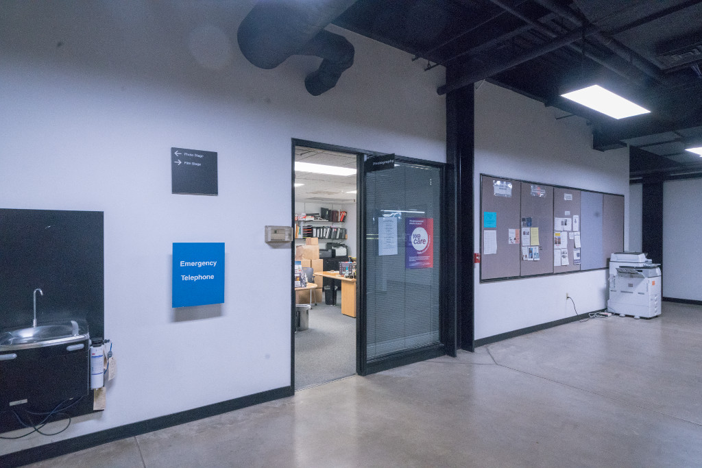
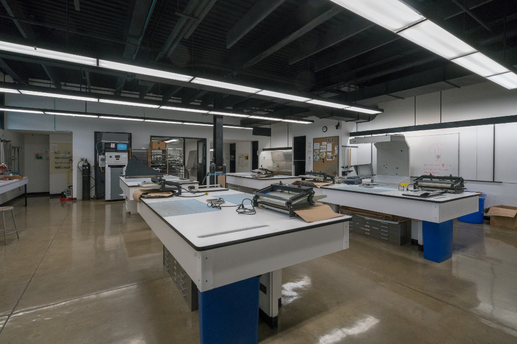
Liberty Island Security Control [Interior] [Art Center College of Design, Hillside Campus, Photo Department Areas, Pasadena, CA] [Street View]
Description: Art Center College of Design has been a leader in art and design education for nearly 75 years. The College offers undergraduate and graduate degrees in a wide range of disciplines, as well as Public Programs offering design education to all ages and levels of experience.
 >
>

Stairway [North Stairway]
 >
>
 >
>
 >
>

Debarkation Area [Locker Hallway]
 >
>
Processing Area [Photo Office]
 >
>
 >
>
 >
>

Air Traffic Room [Room 119]
 >
>
 >
>
 >
>

Control/Conference Room [Film Stage]

Hauk's Office [Room 215/Demolished]
 >
>
 >
>
 >
>

Storage Room [Room 116]
 >
>
 >
>
 >
>

Hallway [Lower Hallway]
 >
>
 >
>
 >
>

Examination Room [Black and White Lab]
1700 Lida Street
Pasadena, CA 91103
http://www.artcenter.edu
https://en.wikipedia.org/wiki/Art Center College of Design
Photo Credit: Yongmei Wang [Rose] [1-6, 9-14]/Yan Da [7-8]
 >
>
 >
>
World Trade Center [50th Floor] [Getty Oil Building, The Mercury, Second Floor, UDream Dental, Los Angeles, CA] [Street View]
Description: The former Wilshire at Western Building was the home of the Getty Oil Company. It was a 23 stories tall derelict office building for many years and it always had "for lease" signs on it. It went vacant in the mid 90s. Then a condo conversion project transformed the building in 2005-2006.
3810 Wilshire Boulevard
Los Angeles, CA 90010
http://themercurycondos.com

World Trade Center [Lobby]/World Trade Center [Stairwell] [Deleted Scenes] [CalArts, California Institute of the Arts, Valencia, CA] [Satellite View]
Description: CalArts is the first U.S. higher educational institution to offer undergraduate and graduate degrees in both visual and performing arts. It was established in 1961 by Walt and Roy Disney through the merger of two professional schools, the Los Angeles Conservatory of Music, founded in 1883, and the Chouinard Art Institute, founded in 1921. CalArts moved to its permanent home in Valencia in 1971 and added degree programs in dance, film and theater to those in art and music.
 >
>
 >
>

World Trade Center [Lobby] [Main Gallery]
 >
>
World Trade Center [Stairwell] [Deleted Scenes] [Character Animation Department Right-Hand Stairwell]
24700 McBean Parkway
Valencia, CA 91355
http://www.calarts.edu
https://en.wikipedia.org/wiki/California Institute of the Arts
Photo Credit: Thomas Sclafani [3]
 [Deleted Scenes]
>
[Deleted Scenes]
>
 >
>

World Trade Center [Exterior] [Century Plaza Towers, 2049, Century City, Los Angeles, CA] [Street View]
Description: Century Plaza Towers I and II are two 44-story, 571 feet [174 m] tall twin towers located at 2029 and 2049 Century Park East in Century City in Los Angeles, California. Commissioned by Alcoa the towers were completed in 1975 and designed by Minoru Yamasaki. The towers resemble his World Trade Center in their vertical black and gray lines and use of aluminum exteriors. The towers have a somewhat unique triangular footprint and are landmarks that are clearly seen around the Los Angeles Westside. Their prominence in the Century City skyline has been reduced in recent years with the addition of new skyscrapers that partially block their view. Nevertheless, the Century Plaza Towers remain the tallest buildings in Century City and the tallest skyscrapers in Southern California outside of downtown Los Angeles. The towers sit on top of one of the world's largest underground parking garages.
2029 and 2049 Century Park East
Century City, Los Angeles, CA 90067
https://www.centurypark.net
https://en.wikipedia.org/wiki/Century Plaza Towers
Theater [Interior] [Wiltern Theatre, Los Angeles, CA] [Street View]
Description: The Wiltern Theatre and adjacent 12-story Pellissier Building are Art Deco architectural landmarks located on the corner of Wilshire Boulevard and Western Avenue in Los Angeles, California. The entire complex is commonly referred to as the Wiltern Center. Clad in a blue-green glazed architectural terra-cotta tile and situated on a diagonal to the street corner, the complex is considered one of the finest examples of Art Deco style architecture in the United States. The Wiltern building is owned privately and the Wiltern Theatre is operated by Live Nation's Los Angeles division and is a well established landmark in Los Angeles. The historic Wiltern Theater originally opened on 7 October 1931 and was later sold to an insurance company in 1956 who ignored it till the late 70s. It was in a bad shape and was saved by a local group of preservationists from being demolished on two occasions. A developer called Wayne Ratkovich later purchased it in 1981 to restore the theater and office building. The renovation of the The Wiltern Theater was complete by 1985. It is currently used for a large variety of events including: rock/pop concerts, dance performances, award shows, television tapings, stage productions, and corporate events.
 >
>

Lobby [Lobby]
 >
>

Auditorium [Auditorium]
 >
>
 >
>
 >
>

Backstage Area [Stairwell] [Stage Door Vestibule]
 >
>
 >
>
 >
>

Basement [Basement/Dressing Room Hallway]
 >
>

Basement [Basement/Green Room]
3790 Wilshire Boulevard
Los Angeles, CA 90010
http://www.wiltern.com
https://en.wikipedia.org/wiki/Pellissier Building and Wiltern Theatre
Photo Credit: Mike Hume [3-7]
 >
>
 >
>
 >
>
 >
>

New York Public Library [Hall] [University of Southern California [USC], Doheny Memorial Library, Ground Level Central Hall, Los Angeles, CA] [Satellite View]
Description: The historic Edward L. Doheny Jr. Memorial Library has served as an intellectual center and cultural treasure for generations of students, faculty and staff since it opened in 1932. Created as a memorial to Edward L. Doheny Jr., a USC trustee and alumnus, this landmark building was USC's first freestanding library. 75 years since its doors first opened, it remains one of the university's most important and popular academic facilities.
3550 Trousdale Parkway
University Park Campus
Los Angeles, CA 90089-0185
https://libraries.usc.edu/locations/doheny-memorial-library
Photo Credit: Ashley Naiyu Chen [1]
 >
>
 >
>
 >
>
 >
>
New York Public Library [Reading Room] [University of Southern California [USC], Hoose Library of Philosophy, USC College School of Philosophy, Los Angeles, CA] [Street View]
Description: The Hoose Library of Philosophy was established in 1929. The collection has more than 50,000 volumes in all branches of academic philosophy. It is particularly rich in materials dealing with the history of modern philosophy, analytical philosophy and metaphysics. The library collects all major English language publications pertaining to academic philosophy. Most of the library's older circulating volumes are stored in the Grand Depository. If you are interested in one of these volumes, click on the highlighted call number on the bibliographic record in HOMER and follow the instructions. Within 24 hours, the desired volume will be available at the circulation desk at the Doheny Library.
The Hoose Library of Philosophy has two collections of rare books that are housed in Special Collections on the second floor of the Doheny Library. The first collection, called the Flewelling Collection, consists of medieval manuscripts, renaissance incunabula and early editions of seminal works in philosophy of the 16th and 17th centuries. The second collection, called the Gomperz Collection, consists of first editions of seminal philosophical works from the 18th and 19th centuries. The Gomperz Collection is particularly rich in German philosophy from the Enlightenment through the epochs of romanticism and idealism. The journal collection of the Hoose Library is extensive. Many of these journals are also available in electronic format.
3709 Trousdale Parkway
Los Angeles, CA 90089-0182
http://dornsife.usc.edu/phil/home/index.cfm

69th Street Bridge [Maggie's Corpse] [Studio City, Garage, Los Angeles, CA]
New York
 >
>
 >
>
 >
>
Liberty Island Security Control [Statue Of Liberty]/Manhattan [Liberty Island, NY] [Street View]
Description: Liberty Island, formerly called Bedloe's Island, is a small uninhabited island in New York Harbor in the United States, best known as the location of the Statue of Liberty. The name Liberty Island has been in use since the early 20th century, although the name was not officially changed until 1956. Before the Statue of Liberty, Bedloe's Island was the home to Fort Wood, an eleven pointed star-shaped fortification made of granite. Because of this, its nickname was "Star Fort".
Mouth of the Hudson River, NY
http://www.nps.gov/stli/index.htm
http://www.libertyellisfoundation.org
https://en.wikipedia.org/wiki/Liberty Island